Most people coming from Kohima to Zunheboto take the Chozuba road (which most people pronounce as 'Chazuba') which passes through the town of Chozuba in Phek district. Technically, it's a state highway, but you wouldn't know from the condition of the year. However, this year they've started work on widening the road. As a result, most of the sumos are avoiding the road and opting for the 'shortcut' which takes the Wokha Road and involves fording the Langki River. So this time I haven't a chance to see the condition of the Chozuba road.
On Monday, we went down to the village of Chishilimi to watch a rain invocation ceremony (sorry guys, still no rain). To get there, we needed to take the Chozuba road past Satakha, up till the village of M Tsügho (aka M6 - the name of this village could be another blog post) which is the last Sumi village before one enters Chakhesang land / Phek district. This gave me the chance to see what work was being done.
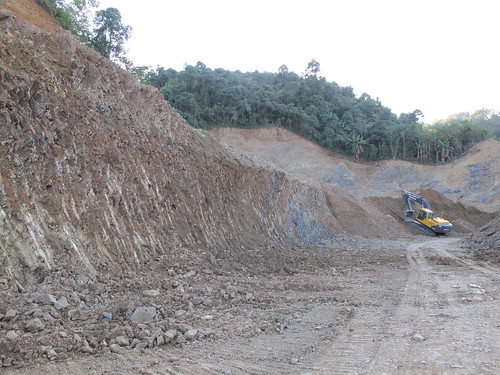
You can see excavators have torn into the side of the hill to make way for the new road. In some parts, it looked like they were making the road as a wide as 4 lanes, which seems ridiculous given that the most travelled road in Nagaland between Dimapur and Kohima is still only 2 lanes wide.
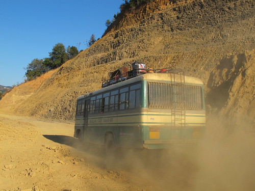
As you can see, the dust from passing traffic is terrible.
But the view is still pretty awesome. The town on the ridge should be Satakha, although to the left, on the same ridge, I think you can almost make out the villages of Khukiye and Lukhai.

On Monday, we went down to the village of Chishilimi to watch a rain invocation ceremony (sorry guys, still no rain). To get there, we needed to take the Chozuba road past Satakha, up till the village of M Tsügho (aka M6 - the name of this village could be another blog post) which is the last Sumi village before one enters Chakhesang land / Phek district. This gave me the chance to see what work was being done.
You can see excavators have torn into the side of the hill to make way for the new road. In some parts, it looked like they were making the road as a wide as 4 lanes, which seems ridiculous given that the most travelled road in Nagaland between Dimapur and Kohima is still only 2 lanes wide.
As you can see, the dust from passing traffic is terrible.
But the view is still pretty awesome. The town on the ridge should be Satakha, although to the left, on the same ridge, I think you can almost make out the villages of Khukiye and Lukhai.
Tomorrow I'm off to the village of Vishepu for a Christmas feast thrown by friends who've come back from Australia. Not sure when I'll post again - maybe just before New Year's.
Happy holidays everyone!
No comments:
Post a Comment